
A lot on the western edge of Boise is listed at $900,000. The county's own assessor puts its value at $228,000. It has sat unsold since its March 2024 listing — roughly 870 days by mid-July 2026 — and the MLS description is almost blank. Everything a casual buyer would use to size it up — the photo, the write-up, the marketing — says next to nothing. The public record says a great deal.
That gap is the whole point of this article. A parcel of land in Boise is one of the most thoroughly documented things you will ever consider buying. Before you make an offer you can find out, for free and in an afternoon, exactly what may legally stand on it, whether it can be split, whether a homeowners' association can veto your plans, and what the county thinks it is worth. Almost none of that is in the listing. All of it is in databases the City of Boise and Ada County publish on purpose.
We used one of our own featured lots — 10685 W Hollandale Dr, Boise, ID 83709, just under half an acre in the Five Mile corridor of south-west Boise — as the worked example, because it is a clean case and because the numbers on it are unusually loud. Here is how to read a Boise lot, using this one, so you can read any other.
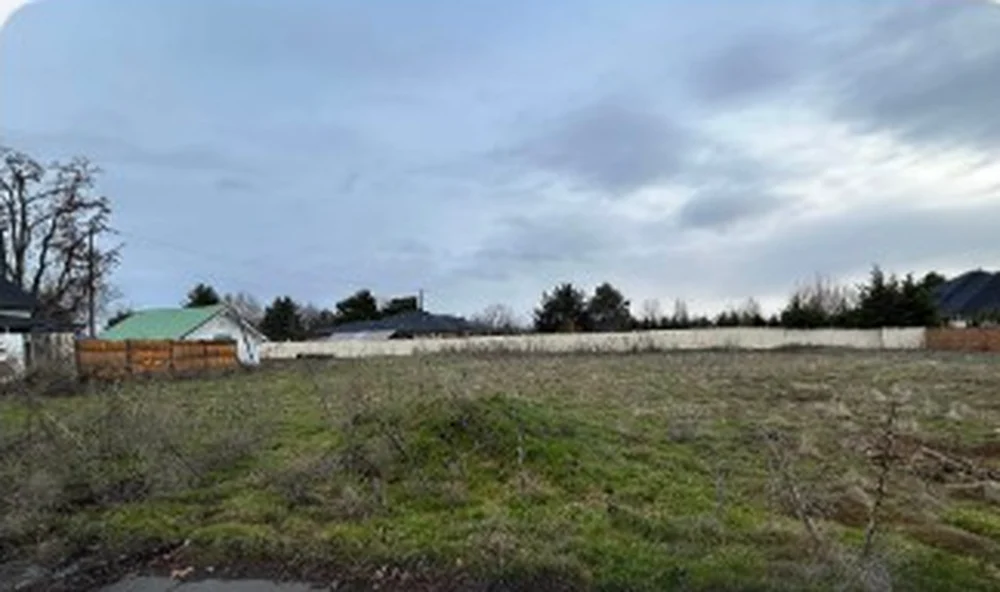
The parcel number is the key that opens every other door
Everything downstream depends on one identifier: the parcel number. For this lot it is S1122417230. Once you have it, every public dataset in Ada County will tell you what it knows about that exact piece of ground.
You find it through Ada County's public GIS. The county publishes its parcel layer as an open ArcGIS service — the same data that feeds the assessor's map — and you can search it by address or click the lot on the map. For 10685 W Hollandale it returns the parcel number, the address as the county records it, the size (0.474 acre, or 20,647 square feet), a property code of `L` for vacant land, the 2026 assessment year, and the legal description. [Verified — Ada County GIS Parcels FeatureServer.]
The legal description is worth learning to read, because it carries a fact the listing will not tell you. This one reads, in part, `PAR #7230 POR N2NE4SE4 SEC 22 3N 1E / PARCEL D R/S 9799`. Translated: it is a metes-and-bounds parcel — a piece measured out by survey — in the north half of the north-east quarter of the south-east quarter of Section 22, split off through Record of Survey number 9799. It is not a numbered lot inside a recorded subdivision plat. Hold onto that distinction; it decides the HOA question later, and almost nobody checks it before they buy.
| What the record shows | 10685 W Hollandale Dr | Where it comes from |
|---|---|---|
| Parcel number | S1122417230 | Ada County GIS |
| Size | 0.474 acre / 20,647 sq ft | Ada County GIS |
| Zoning | R-1A (Residential Large Lot), City of Boise | City of Boise zoning layer; Ada County zoning layer |
| Minimum lot size in R-1A | 20,000 sq ft | City of Boise, Title 11 Table 11-02.3 |
| Maximum density | 2.1 dwellings per acre | City of Boise, Title 11 |
| Setbacks | front 20 ft, interior side 10 ft, rear 20 ft | City of Boise, Title 11 |
| Maximum building height | 35 ft | City of Boise, Title 11 |
| 2026 assessed value | $228,000 (all land; parcel is vacant) | Ada County GIS |
| Asking price | $900,000 | Live Here Boise listing data, 20 Jul 2026 |
| On the market since | 1 March 2024 — roughly 870 days by mid-July 2026 | listing record |
The zoning tells you exactly one house may stand here
The single most useful thing the record gives you is the zoning code, because zoning is the rulebook for what you are allowed to build. This lot is R-1A, Residential Large Lot, in the City of Boise. That is confirmed three ways over — the zoning field on the parcel record itself, Ada County's zoning layer, and the City of Boise's own published zoning map all return R-1A — which is the kind of agreement you want before you rely on a number. [Verified — City of Boise zoning layer and Ada County zoning layer.]
R-1A is Boise's largest-lot residential zone, introduced in the city's 2023 Zoning Code Rewrite. Boise adopted its Modern Zoning Code in June 2023, effective that December — the first complete rewrite of the code since 1966 — and R-1A is the "estate" tier, described by the city as intended for "predominantly residential uses on large 'estate' style lots that allow low-density development and preserve a character in which homes are separated by relatively large yards." [Verified — City of Boise, R-1A district page.] Blueprint Boise, the comprehensive plan, marks the future land use here as Suburban. There is no commercial or mixed-use designation on the parcel.
The dimensional standards are where zoning stops being abstract. R-1A sets a minimum lot size of 20,000 square feet, a maximum density of 2.1 dwellings per acre, minimum setbacks of 20 feet at the front, 10 feet on interior sides and 20 feet at the rear, and a maximum building height of 35 feet. [Verified — City of Boise, Title 11 Table 11-02.3, published on the R-1A district page.]
Two conclusions fall straight out of those figures, and you can reach them yourself with arithmetic, not opinion. First: at 20,647 square feet, this lot clears the 20,000-square-foot minimum by about three per cent — 647 square feet to spare. It is a legally buildable lot for exactly one house, and it cannot be split, because two lots would together need 40,000 square feet and there are only 20,647. The density cap says the same thing a second way: 0.474 acre times 2.1 dwellings per acre is 0.99 of a dwelling. One. Second: the 35-foot height limit is no real constraint for most Boise homes — it comfortably allows two full storeys. On a lot like this the brake on the design is the setbacks, not the height. Subtract the side setbacks from the width and the front and rear setbacks from the depth, and roughly 112 by 115 feet is left to build in. That is generous. The rules here get in almost nobody's way.
There is one small standard that surprises people: R-1A's streetscape rules require a detached sidewalk at least 5 feet wide, separated from the curb by an 8-to-10-foot planting strip with a street tree. [Verified — City of Boise, R-1A district page.] If you are budgeting site work, that green strip is not optional.
Whether you can add a second home is a genuinely open question
Buyers routinely ask whether they can put a second dwelling on a lot this size — a guest house, a rental, a place for a parent. In R-1A the answer is a qualified yes, through an Accessory Dwelling Unit, and the qualification is where you need to slow down.
Boise's ADU Quick Guide lists R-1A among the zones where an ADU is permitted, and the city's ADU one-sheet sets the ceiling plainly: an ADU may not exceed 900 square feet, or 70 per cent of the main house's floor area, whichever is smaller, with a limit of two bedrooms and one ADU per lot. The minimum-lot-size and density rules that block a second primary dwelling do not apply to an ADU. [Verified — City of Boise ADU one-sheet.] So a detached studio or guest pavilion of up to 900 square feet is allowed here by right.
But there is a real tension in the paperwork, and the honest thing is to name it rather than pick a side. That 900-square-foot ceiling is the City of Boise's figure. Our research also flags an Idaho state ADU statute, Senate Bill 1354, cited at a considerably larger ceiling of 2,250 square feet — a number we could not independently confirm against the statute text, and which we could not reconcile with the city's one-sheet. When a city rule and a state rule appear to disagree on the same question, you do not average them and you do not guess. You ask the city, in writing, for the standard that governs your parcel. That is exactly the situation Boise's Concept Review process exists for, and it is why the code points you to a planner before you draw anything.
An HOA can only say no if your lot is inside one
This is the check almost every buyer skips, and it is the one that most often overturns a plan after closing. The question is whether a homeowners' association, with the power to approve or reject what you build, has authority over your specific lot.
Here the legal description already answered it. Because 10685 W Hollandale is a metes-and-bounds parcel and not a lot in a recorded subdivision plat, it is not automatically inside a subdivision HOA. Its neighbours on the same street are platted — they sit in Hollandale Estates — but this parcel falls outside that plat. A spatial query does return a "Southwest Ada County Alliance" at this location, but that is a recognised neighborhood association — a group the city consults on permit applications — and not an HOA with property rights or an architectural review committee. [Verified — Ada County GIS, subdivision and neighborhood-association layers.] The two are easy to confuse and completely different in power.
What the GIS layers cannot tell you is whether a private covenant, easement or irrigation right is recorded against this specific parcel. A metes-and-bounds lot can perfectly well carry a restriction — a shared-driveway easement, an irrigation ditch right, a recorded CC&R — that never appears on a zoning map. The only way to know is a title report or a search at the Ada County Recorder against Record of Survey 9799. For any land purchase, that search is the difference between "the map says I can" and "I actually can."
The county's value is not the market's price — but the distance between them is information
Now the number that started this article. The 2026 Ada County assessment for this parcel is $228,000, and because the lot is vacant, that is entirely land value. The asking price is $900,000 — roughly four times what the county assessor determined. [Verified — Ada County GIS, total-value field.]
An assessed value is not a market price, and it is important to say so cleanly: the assessor is valuing for taxation on a mass-appraisal cycle, not setting what a willing buyer will pay. A home priced above its assessment is not automatically overpriced. Idaho land has appreciated hard, and assessments lag. So a gap is normal. What matters is the size of the gap, because that is where information lives — and here the surrounding record lets you calibrate it precisely.
The cleanest comparison is directly across the street. 10733 W Hollandale Dr is the mirror twin of our lot — split from the same Record of Survey, the same 0.474 acre, the same R-1A zoning — and it is assessed, with a house already on it, at $740,600. In other words, the $900,000 asked for the bare lot exceeds the county's value of the identical neighbouring lot including its finished home. Widen the lens and the built R-1A lots up and down Hollandale Drive, most of them nearly twice the size at about 0.92 acre, are assessed between roughly $497,000 and $647,000 — again, land and house. [Verified — Ada County GIS.] A vacant half-acre is being offered for more than full-acre neighbours with homes on them.
And there is no hidden development value closing that gap. The lot cannot be split. There is no development agreement on it, no airport influence area, no historic-district overlay. There are mixed-use and denser-zoned parcels within a few hundred metres along the Five Mile corridor, but that zoning sits on other people's land; this parcel is R-1A with a Suburban future land use, full stop. [Verified — Ada County and City of Boise GIS layers.]
None of that makes the price wrong in any legal or moral sense — a seller may ask what they like. But a listing that opened on 1 March 2024 and, by mid-July 2026, had gone roughly 870 days without a buyer — with a nearly empty MLS description and a price at four times assessed value — is a pattern, and reading the record is how you see the pattern before you write the offer instead of after. That is the difference an agent who does this homework makes: not talking you out of a lot, but making sure you know what you are looking at.
How to run this check on any Boise lot yourself
The method generalises. For any parcel in the Treasure Valley, the sequence is the same. Start at Ada County's GIS and find the parcel number, the acreage, the assessed value and the legal description; note whether it is a platted subdivision lot or a metes-and-bounds parcel. Take the zoning code to the City of Boise's zoning district pages (or the relevant city, or Ada County's code for unincorporated land) and read the dimensional standards — minimum lot size, setbacks, height, density — and do the arithmetic on whether your plan fits and whether a split or an ADU is even possible. For anything with a second-dwelling or subdivision angle, request a Concept Review Meeting with a city planner, who will give you the standards that apply after the latest code amendments in writing; Boise's planning division takes those requests at (208) 608-7100. And before you close, order a title report or search the Ada County Recorder for covenants and easements the maps cannot show. Two hours of this saves the buyer who does it from the surprise that ambushes the buyer who doesn't.
What the record could not tell us about this lot
Reading the public record honestly means marking its edges, and there are several here we could not close from the desk. We could not view the text of the most recent code amendment (Boise reports its current Development Code has incorporated Ordinance 25-25 since spring 2026, and the searchable codified version was not yet available); the dimensional standards above come from the city's district page, and whether that page already reflects every post-amendment change is not something we could independently confirm. We could not establish the parcel's FEMA flood zone, whether it is on Boise sewer or septic, or whether an assured-water-supply obligation attaches — all answerable, but only through the city and the utility, not the map. We could not confirm the 2,250-square-foot state ADU figure against the statute, only note that it conflicts with the city's 900. And we did not pull the full MLS history or sales record; the days-on-market and asking price come from the listing as of July 2026. On a purchase this size, each of those is a question to put to the city, the title company or the listing agent in writing before you rely on the answer — which is, in the end, the entire lesson: the record tells you an enormous amount, it tells you exactly where it stops, and the good decisions live in knowing the difference.